 Rasmustinden is a tall, 1224 m (4016 ft), peak near Laksvatn, a 50 km drive south of Tromsø. The north facing side of the mountain is pretty steep an crag-like, so the hiking route we took brought us far into the valley under Rasmustinden and climbed the south face.
 Our trail today started at a small parking lot just off the main road. The trail climbed a the edge of loose dirt along a hill that has been excavated next to the river. From here the trail followed along the river bank, but we were high above the water. In some places there was more than one trail, where one trail stayed very close to the edge and the other further away. The trail followed a tractor road and then looped back to the river once more. From here the trail was much less traveled. There were fallen trees blocking the trail and spots with moss covered rocks that we had to scramble across. There was also a lot of wet sections, so good hiking boots were a must. As we skirted the hillside along the river, we had great views of the mountains and fjord behind us and of the small rapids in the river.
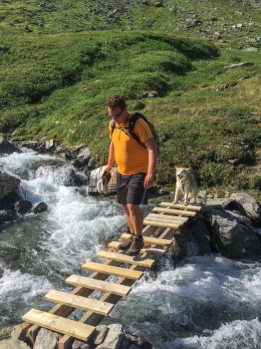
 Once we gradually climbed to tree line, we crossed the river on a small bride that was missing a plank.. but seemed secure. Jack even crossed it on his own too. The trail on the other side was a bit further from the side of the stream now, but continued up along the valley as we now walked beneath Rasmustinden. Looking up the mountain felt very close, but seemed quite steep.
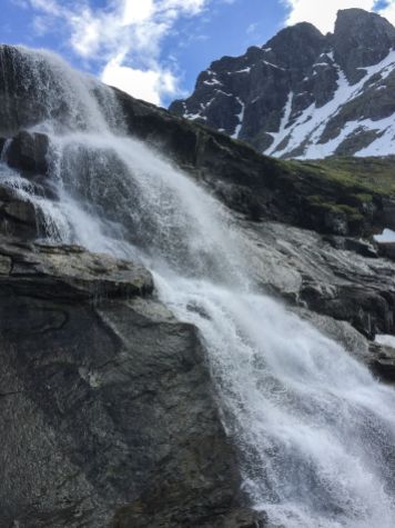
At the end of the valley the trail crossed another small stream and climbed along the side of an impressive waterfall. The rocks here were wet and some were very slippery, and there was also still quite a bit of snow around.  We climbed along the side of a snow field cutting across the south side of Rasmustinden. The trail was very mossy and green in this area leading to a wet flat area below the top. The last bit of the hike was a long steep scree field. There is a trail leading through much of it, but in some spots the rocks were all gone, exposing the slippery dirt surface beneath. This last section took us quite a while, even though we were really pushing for the top.
  One thing that I love about these summits is that the view on the far side of the mountain is a surprise. And this one was really great. At the top the mountain falls off to the North, there is a lovely lake below and the views of the surrounding mountains and the fjord really completed the scene. To the Northeast we could see Blåtinden that we hiked last weekend and the Gjømmerdalsbreen ice field, that we hope to hike to soon!
It was a beautiful day, so we relaxed in the sunshine at the top. Jack curled up in a little nook by the summit cairn and took a nap. We all needed little break after the long hike. This trail is 10.4 km (6.5 miles) round trip, but somehow felt much longer. After a few photos, we headed back down and made sure to get some more pictures of the waterfalls and streams on the way back.
Photo Gallery:


