 I’ve mentioned in other blogs before, a great resource for hiking in Norway is Ut.no. This site has maps and the descriptions of hikes in mountains. It is also by far the best source for topographical info and finding the names of various geographic features that I’ve found online. While using this site the other day, I discovered a trail nearby that went to the edge of a glacier or ice field. Jesse and I have had very few chances to see glaciers up close here in Norway, though we’ve both tasted fresh glacier water melting from the bluest ice I’ve ever seen on our trips to Alaska in the past. On a recent hike to Blåtinden we were very close to Gjømmerdalsbreen, but it is cradled in the mountains and wasn’t visible from our hike. Gjømmerdalsbreen is, in a grander perspective, a small alpine glacier. Today Jesse, Jack and I set out to find the ice on a long trail, well over 6 km one-way.
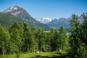
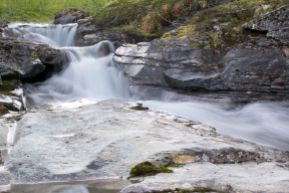
 This trail started behind Laksvatn barnehage by the soccer field. We walked along the ski track for a bit, and then saw a red arrow that we followed. While this was not the correct route, it had some great views of the glaciers and ice caps on the Lyngen alps. That red arrow likely indicates a ski trail that was taking us too far to the west. So we backtracked, and just a little bit past the red arrow on the ski track, we found another trail off to the left that also had a red blaze. This trail was relatively well marked as it used to be a Ti på Topp route some time ago, but was very overgrown. Parts of the route had ferns and other plants approaching 5 feet tall! It made watching your step a bit difficult, there were many rock, holes and tree roots to avoid, and lots of flies as well. the trail mostly cut along the side of the mountain, crossing a number of streams. It was very warm a humid until the trail started steeper uphill and we reached tree line, where there was at least a slight breeze. We stopped along the side of the stream with a view of a waterfall to have some snacks. This spot also had good views of the mountains on Lyngen again.
 From here the trail followed the stream past a number of rapids and waterfalls and then crossed the rived. There were traces of an old bridge that had been washed out, so Jesse and I took off our boots and walked through the stream. Even though it was a warm day, it was cold enough to be quite painful. Jesse would say it was “refreshing.”
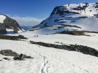
  The route followed the stream further and climbed up a steep section to a large valley below Blåtinden. The valley still had snow and more waterfalls falling from the surrounding mountainsides. Only now could we see where the trail continued, as there was a large ramp built into the mountain leading up towards the ice fields. Partially up this rocky section the trail splits. There were no signs, but we learned from another hiker that the trail to the right climbs up the Gjømmertinden, so to go to the glacier we took the trail to the left. Just over a small hill from the junction we were shocked to find the whole valley before us was filled with snow.
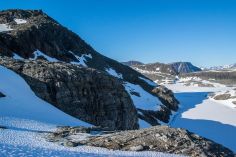
 We knew we were hiding to a glacier, but really had no initial intentions to hike on it, but this section the snow seemed to just be collected from winter. We skirted the snow, staying out of the low sections on the snow, which was soft since it was a warm day. The valley was pretty long and we continued through it until we reached a small saddle. On the other side of the saddle the mountain dropped down to a glacier lake, with incredibly blue water that looked like it was just starting melt for summer. The route climbed to the left on a very steep and loose scree field, than thankfully was not very long. At the top of that we could see the expansive ice field. There were cracks in the ice in front of us, indicating a lake thawing below the ice. We could hear the melt water from the lake and ice running under the ice down to the larger lake below.
 Just across the stream was a small island of rock surrounded by snow. This was the top of the Tip på Topp hike, Gjømmerdalsbrea. There was a logbook there that we signed. Jesse was ready to sit and have lunch, but I wanted a higher vantage point to see the glacier. So we hike just a bit further to the top of the small 974 m tall peak. The views of the glacier were pretty spectacular. We were surrounded by snow and ice.
  After the long hike, we took a well-deserved break at the top in the sun. The top had quite an edge to it, with steep rock walls falling away down to the large glacier lake below. It was so quiet. We only met one other hiker on the way up, but from our picnic site, we saw 2 skiers making their descent on the glacier and down the trail that we had hiked. It seemed like a very long hike to do with skies, but they were hooting and hollering, so it must have been worth it!
This trail was one of the most diverse we’ve hiked here, from alpine ice fields, scree, river valley to the almost jungle-like trail at the bottom. It was an unexpected and wonderful surprise!
Photo Gallery:


One thought on “Gjømmerdalsbreen – Finding the Ice”